There’s a little known requirement that you have to go on a full day out on your motorbike within a week of getting it.
Actually, that’s not true. But it should be true.
To do my part then, I decided to take a day off and ride down the Pacific coastal roads to the southern end of the Izu peninsula, to Shimoda.
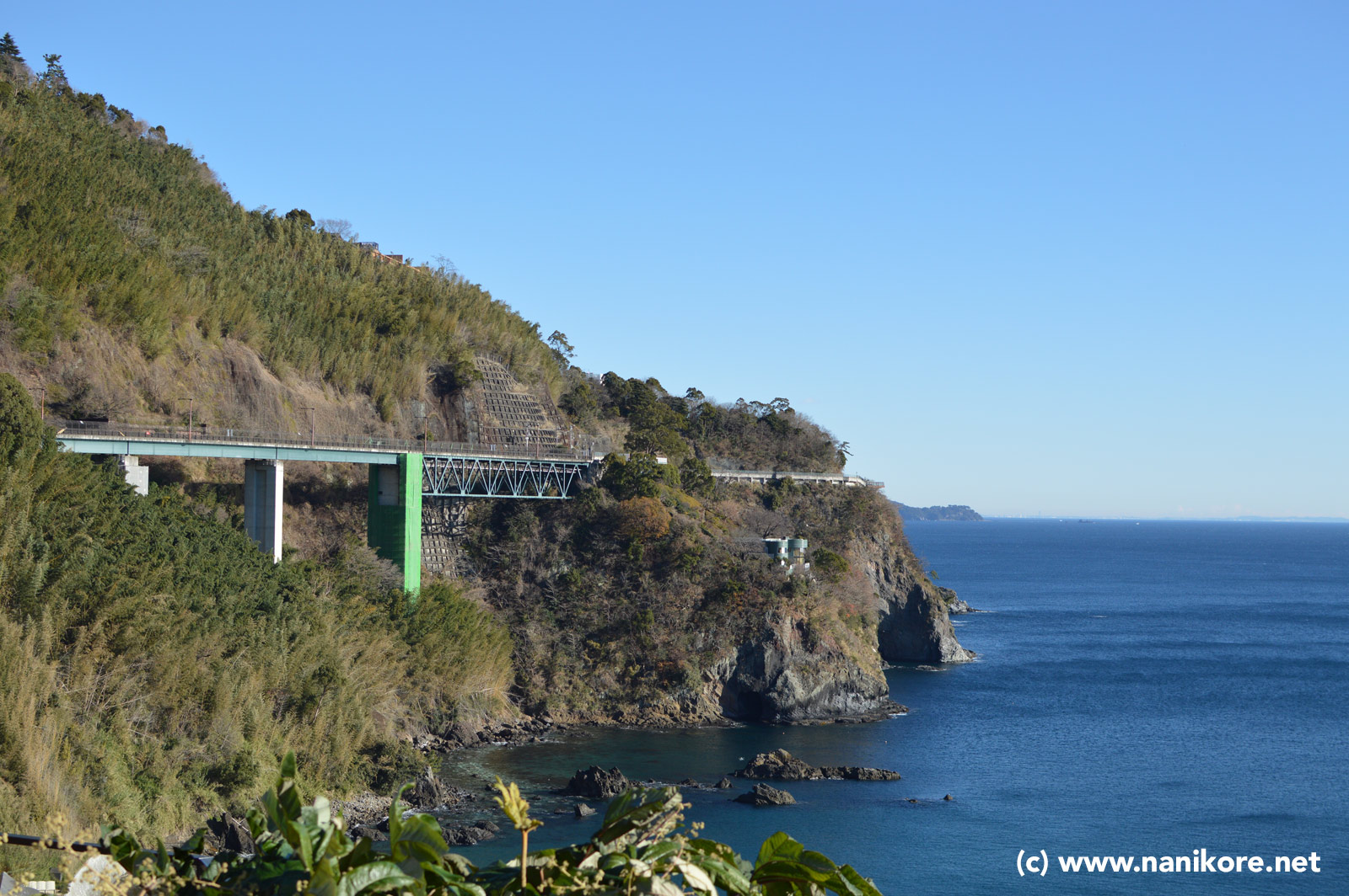
I love coastal roads; just riding along, with the vast ocean on one side - hopefully with a sturdy looking metal barrier between you and the cliff down to that ocean - and a rising mountain on the other.
If this sounds good to you, then welcome, and come on down to Routes 134 & 135 on Japan’s Pacific coast.
The day started at around 7am, I’d gotten all my layers on, and warmed the bike up a little too, and then made sure I had a hot flask of tea in my backpack. The sky was a perfect blue, with almost no cloud, bright sunshine, and most importantly at that time - no ice or dampness on the road.
Since I was exploring the new Yamaha as well as the road, I decided to give one of the ‘other’ riding modes a shot - it has A, B and Standard. I’d only been using standard up until now, but decided to give ‘B’ a try as this is intended as the smoother, power-reduced rain mode. I thought that would give a nice gentle start to the day. Indeed it is exactly what that suggests - it’s smooth - it really is a wonderful mode to start the day on. It still pulls, there’s still the torque, but it’s like it’s massaging you into the ride.
The coastal road I take is a toll road, it’s true, but raised up, you get to look down on to the beach and the rivers flowing into the ocean as the sunrise hits the beach and you get to see the sun on the side of Fuji-san, all snow capped, before looking left again at the handful of surfers and fishing enthusiasts casting out from the beach. Part way along this straight section is the Seisho Bypass Service Area (SA). It’s often a big meeting spot for motorcycle groups, but as I approached it I didn’t see a single bike unfortunately, so I passed it by this time. When I’m riding alone, if I see some people in there, I’ll sometimes stop off for a chat and exchange route ideas and good stopping points - but not today!
There was something of a cross-wind on the road, but unlike the old Honda, this was much less tiring (and chilling) thanks to just the small amount of fairing and screen on the Tracer, and the bike held its speed more consistently.
Once you get a little past Hayakawa at the west end of the road, the twisties start kicking in, rising and falling around the cliff edges, switching from cliff cutout roads, to short bridge sections seamlessly. It’s fun. Again, there’s a choice of free roads with a little more traffic, or toll roads, with a little more flow. Be aware some of these toll roads are not ETC/NEXCO ones, you need to stop and pay, a bit like the Izu Skyline.
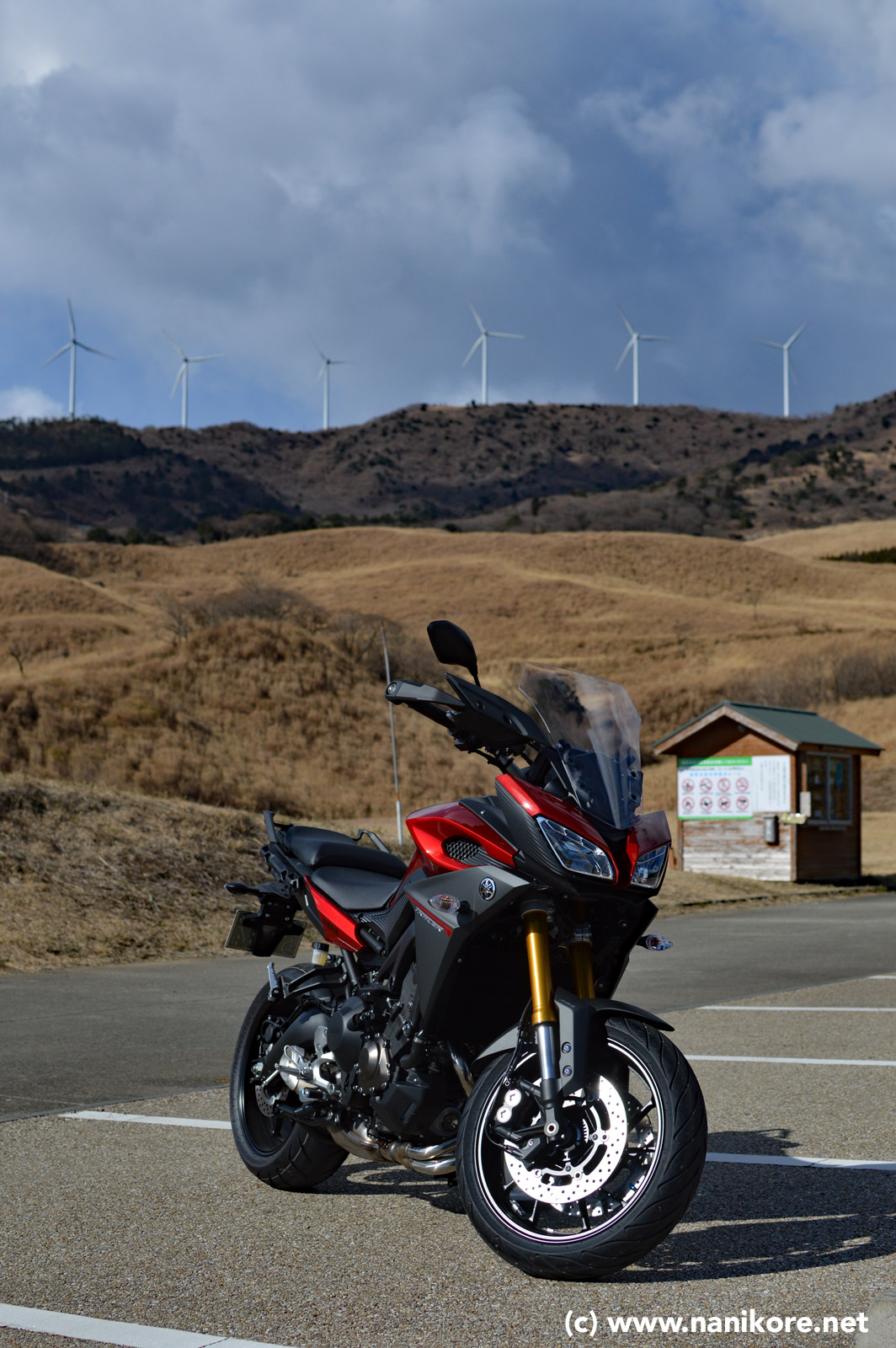
The road takes you down past coastal towns like Manazuru, Atami and Ito, but as I rode along I saw a couple of small signs for some place called ‘Hosono Highlands’, which sounded interesting, so I turned up an already narrow road, up into the hills, where the road gave way to a narrow, barely paved forest track, past some camping and cabin areas, before popping out into a clearing with what looked like some brand new parking spaces - the Hosono Highlands!
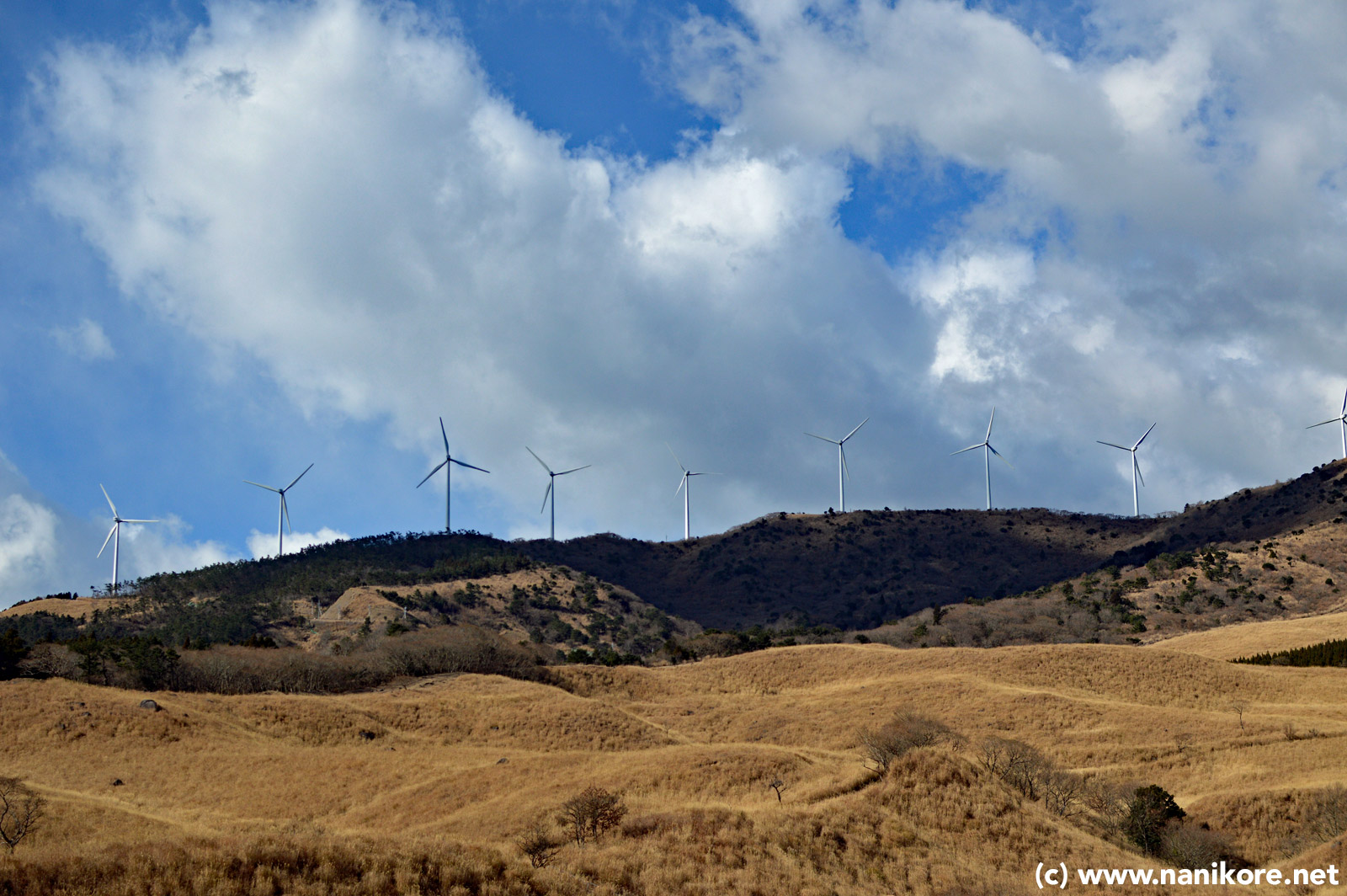
I parked up, and was having a nice cup of two when a couple of cars pulled up coming the other way, and out jumped eight retired people, who made a bee-line for the bike and we spoke for about ten minutes about why we were all here - they had planned to come up, to see the highlands, whereas I was there almost by accident. We also discussed whether Japan still makes good motorbikes (they do), whether English is difficult to learn (it is), and after a swift toilet break, they jumped back in their cars and left. One of the drivers had commented the road extended further up in to the the mountain, past a golf course, to the wind turbines I could see higher up.
It looked like a nice road, so after pondering the view, I decided to go up a bit further. For about a kilometre it a was fun, cracked road surface, steep inclines and corners, with autumnal leaf-fall and branch debris here and there, so it took some concentration.
Anyhow, I came around a corner into a shady wooded area and saw what looked like a run-off stream actively flowing across the road. Not so unusual in the hills around here, but only when I was too close to it did I realise from the reflections that it was actually solid ice.
Pants.
All I could do was make no change to my speed or direction and hope I was balanced enough to get over. Fortunately it seemed I was, though for a second or two I could feel the ice passing under the tyres, but my momentum carried me over. I decided to get off and take a look at how this thing had duped me, and sure enough the water had frozen in rivulets rather than as a flat sheet, and was well over a centimeter thick even at its thinnest point. I decided then it was better to GPS mark the road, and come back to do it in the Spring, rather than have less luck further up!
Fortunately, those leaves and such at the side of the road had virtually no ice on them, and so it was quite simple to walk the bike back down that way, bypassing the frozen stream. It was disappointing, but that road will make a nice addition to a future day out on warmer days.
Back down to the coast road, and more great views and soon another small road, this time down to a beach, which, given that it was about 5degC., was pretty much deserted. However, given the blue skies and sunshine, if you didn’t know that, you could think from a photograph it was a wonderful Summers day.
It’s called Sotoura Beach, and when the weather gets a little warmer, has quite a good crowd down there. On this day though, it was just me, and some fisherman repairing nets in the small harbour nearby.
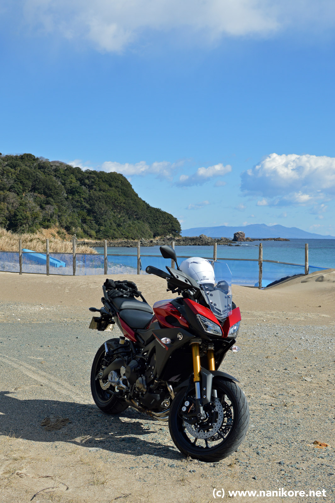
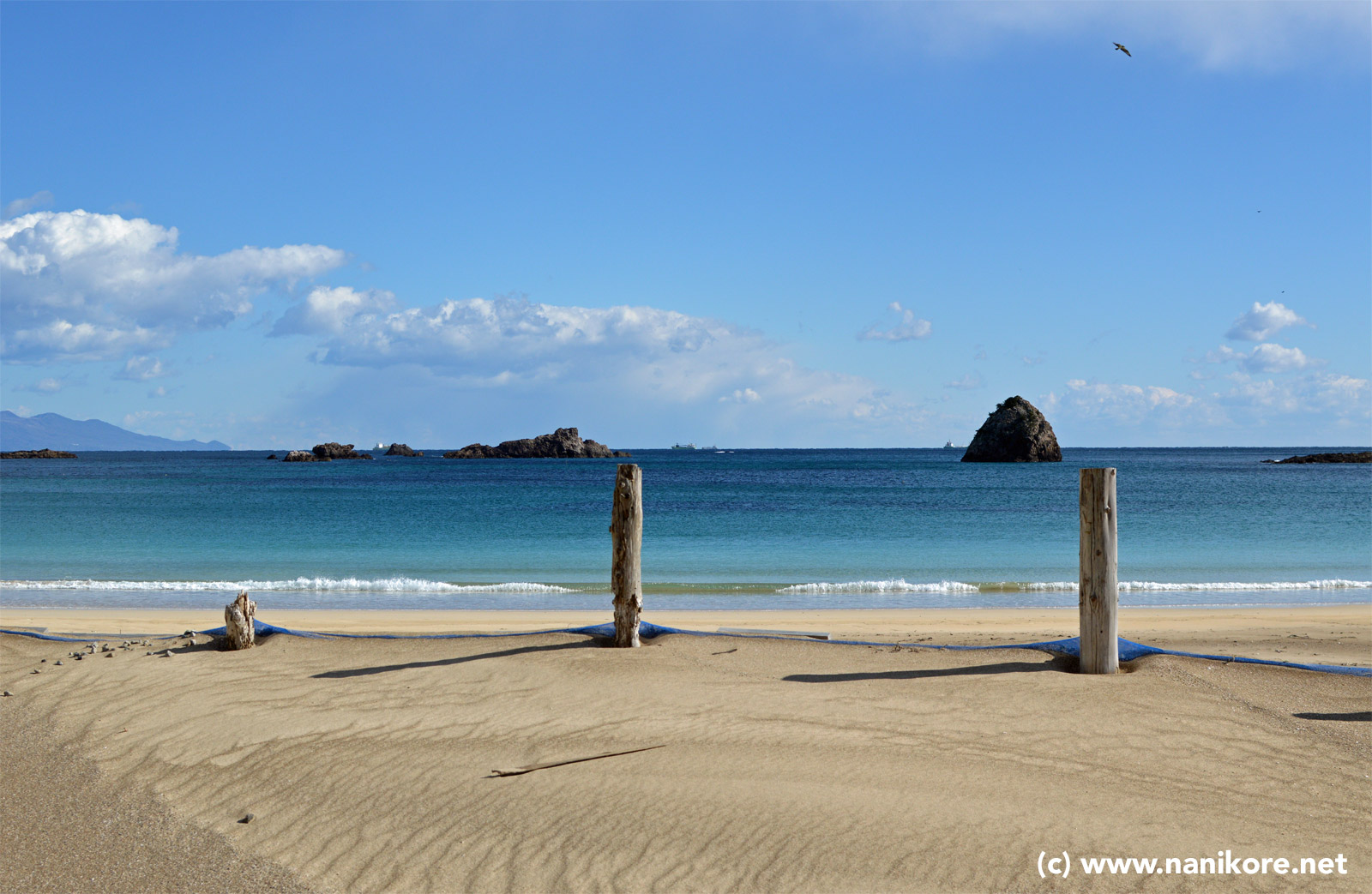
(Note that in a few photos my bike looks like it is on sand - it isn’t - I walked out to check the area and found it was actually an old asphalt car park with a very thin layer of sand and gravel on it.)
After another cup of tea just looking at that blue ocean, I pushed on just a few more kilometres to my lunch spot, the appropriately named Cafe Mellow
[As this post is a little long, I won’t fully recount the trip back, which was yet more happy riding, avoiding some bad drivers, and getting to test the headlights out. I’ll also see if I can get a short road video together for it. After 350Km that day, I have to say, I’m really pleased with the Tracer for sure. ]