When I’m out and about I’ll often take a look at my map book to get a rough idea for a route or destination, and then just go, stop if I think I’ve missed a turn somewhere, or keep going if I just accidentally found a really good road. It’s a fairly relaxed approach I admit.
Sometimes though, I want to follow a specific route, either one someone has sent me, one I’ve specifically made myself, or even one the fevered algo on Kurviger.de has come up with. In early 2017 I started trying out some different smartphone apps, as well as dedicated route navigation devices such as those from Garmin. After a bit of poking around, borrowing kit from friends, and a lot of tea drinking, I settled on the (free or) pay-for OSMAnd + app on Android and iOS.
The Maps
Per its name, it uses the free and open source OpenStreetMap [OSM] data and has the benefit that you can download map regions to your phone for free via the app - no update fees like the older Garmins, no sending units away or any of that.
Having it local is also going to save on data during rides if you even have signal, and some power and heat on the phone as it works it’s tracking and calculating magic.
I should explain a caveat at this point: currently here in Japan, we can’t download Google Maps for licensing reasons, so to use them you’ll be needing need signal and when I go up into the mountains, there often isn’t any. Also, Garmin support is via a fairly pricey 3rd party.
OSMAnd+ can read . gpx files in from other navigation systems and sites, so you can make use of the aforementioned Kurviger and other routing packages and websites. More recent versions will also work with .kml files apparently, but I’ve not spent time with that, so I’ll neatly side step it.
Along the way of learning about navigation and GPS systems, I’ve had to try to teach myself a bit about tracks and routes. In broad terms, a track is a larger file, but has a higher resolution number of GPS points to follow, meaning an app can usually place them on a map and get the roads you meant more accurately. The limiting downside being that many apps and devices have a limit to how many of these points they can render. These are usually the files created when you record a run too. A route has fewer points, but then the app/device will use its logic to decide how you get from one point to the next, depending on your settings, so two riders with two different apps or devices and settings, may go down different roads.
In Use
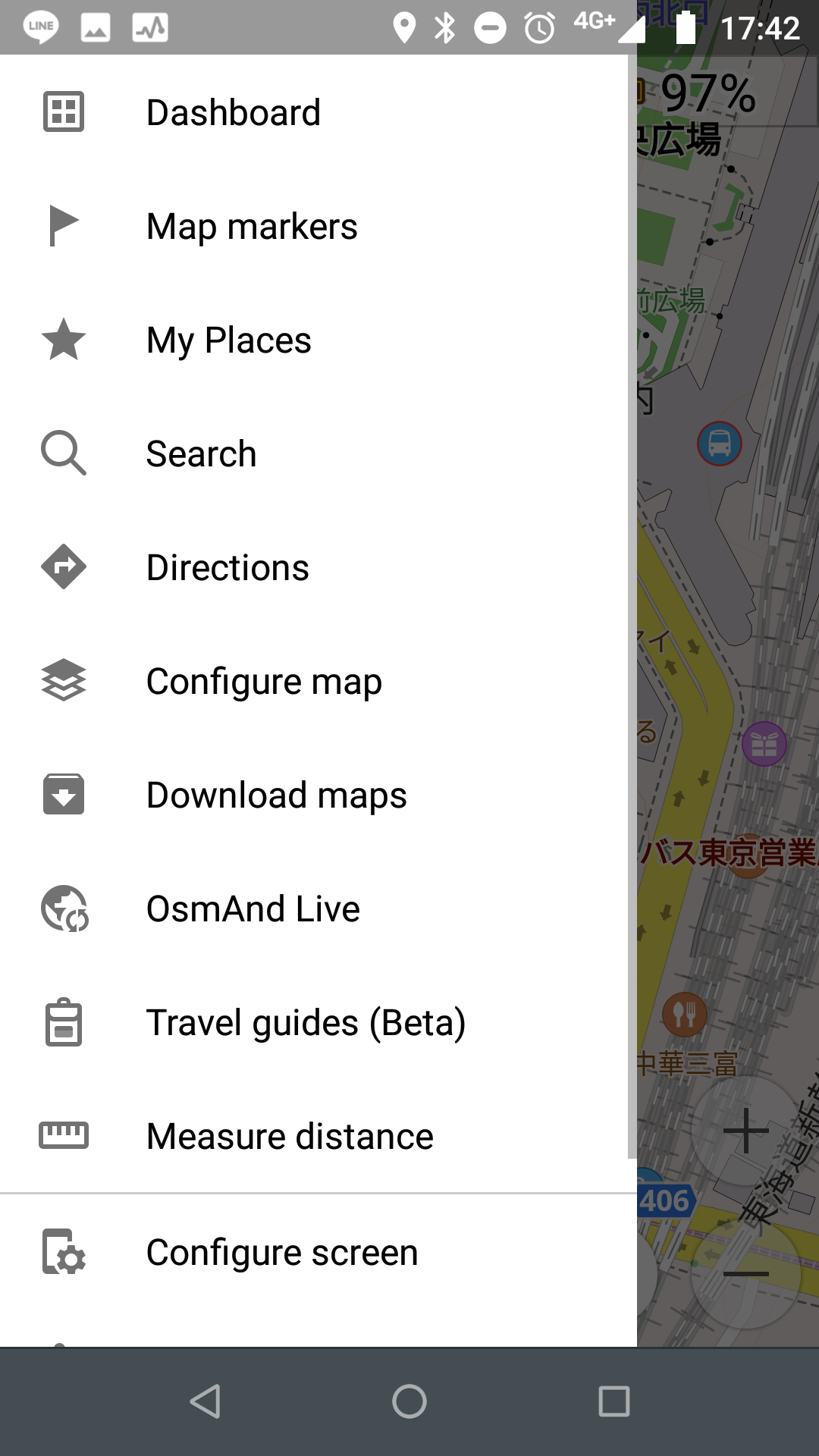
Setting A->B (via C) routes on the phone is simple and whilst there is an array of options around that, the defaults work well. The developers frequently update the app and its user interface, and it’s become a lot neater over the last year or so, and some of the options have been clarified and moved around.
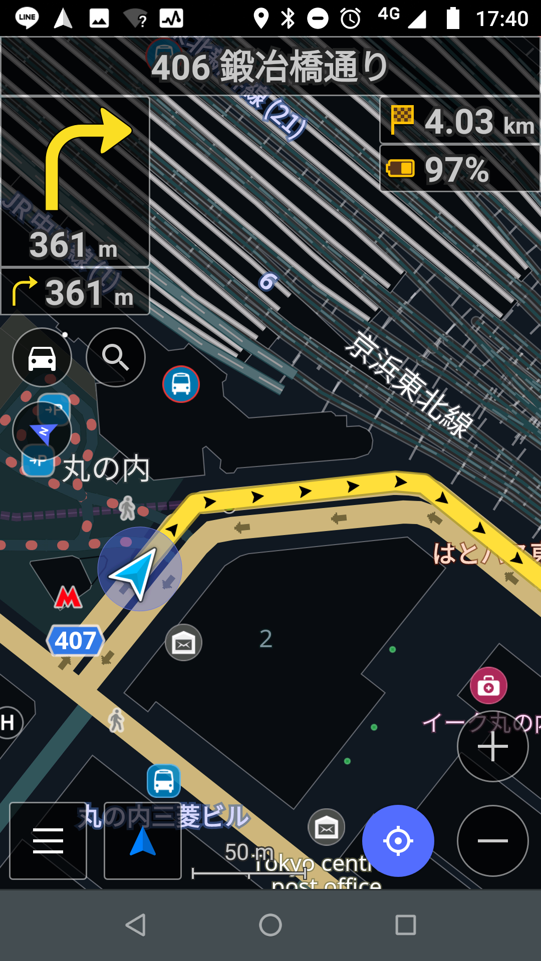
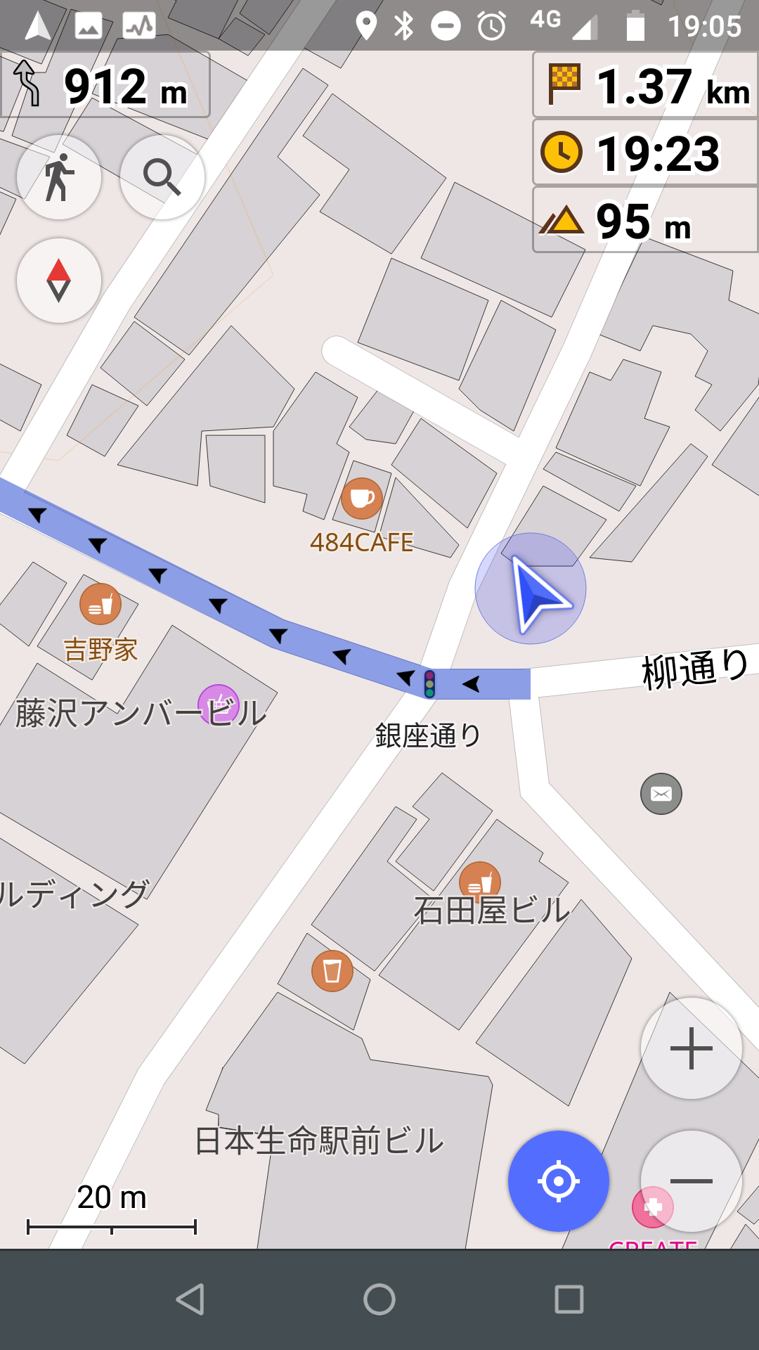
It also allows you to chose what’s on screen while you’re riding such as distance to destination, estimated time left, and even if you’ve accidentally gone a certain amount over the speed limit. There’s quite a lot of information and tutorials on their site and YouTube as well.
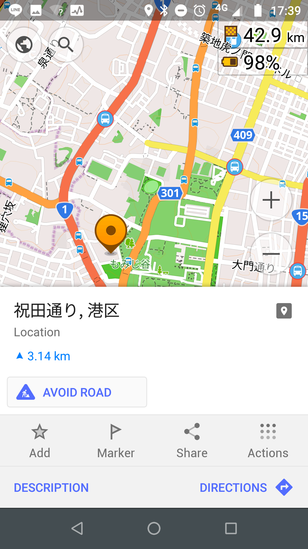
You can import tracks or routes to the app from an email attachment, Google Drive or a local file. If you prefer you can make one yourself on your phone by selecting points manually, and letting the app decide the route based on your preferences.
Location points you add and save you can also see on the map by folder group which is great, meaning after you’ve added quite a few, you can choose to only show the ones you need for a certain trip. It can also show points like fuel stations, convenience stores and such from the OSM database. I will admit I sometimes cross reference these with Google Maps for opening times.
It also has text-to-speech voice instructions for a lot of languages, meaning you don’t have to look down at the phone if you have a Bluetooth communicator. Given I ride a lot of tight mountain twisties though, it can get comical when it tries to keep up with the rapid turns, so I often mute it for those stages, as it trips over itself with left and right instructions. One other note on the voice, for a tight turn I would call a hairpin in the UK, the TTS (even the UK English one) refers to it as a ‘U turn’.
The app also has some interesting plug-ins, such as one allowing you to record video and audio into the app for a given location, which is a nice touch if you do ride reviews, and is free. There are also pay for plug-ins such as for nautical information, and specific data like ski areas, and 3D hill shading.
Caveats
OpenStreetMap and Google Maps are sufficiently different that designing a track on one may not get you the exact same thing on the other, though broadly they can interoperate, depending on settings. The main practical issue is that Google doesn’t like outputting .gpx, so you may need to convert with an app or a website, or try that new kml functionality.
In the near two years and multiple versions I’ve used, only once did the OSMAnd+ developers fundamentally break the app for me - a zooming issue in certain languages which sent it into a loop - though the developers did provide an older version for manual install (since Google Play doesn’t easily allow roll-backs), and that was at least a work around. It’s the old adage - “never do an update just before a ride”.
Is it worth paying for?
When I bought my copy, the main difference was the number of .gpx files you could hold at once on a device, but that’s not really a limitation for most people I suspect. I paid to help support it really, and perhaps because of that I saw decent email support responses, but the official forum also seems to get adequate response times. I personally believe in supporting developers of apps I get worth from, and I also bought the contour and shading plug-ins to get an idea of the terrain I’m riding, as I live in a mountainous area, so I can gauge how much vertical I’m looking at. All in all, I find it a useful app for the average touring biker.